Interactive hiking guide
Walker's Haute Route
The Walker's Haute Route may have many route variations but there's only one mission: hike from Mont Blanc to the Matterhorn. This route connects the two most iconic mountain peaks in Europe and typically it takes 14 days, but we wanted to speed things up and ended up planning a 11-day itinerary. In this guide the route map outlines the classic route with possible variations.
You'll hike in two countries, but you'll experience three cultures: French, Swiss-French and Swiss-German. There are a lot of mountain huts along the way so you could complete it without camping. You'll pass through many Alpine towns which have hotels and restaurants, however that also reduces the feeling of isolation.
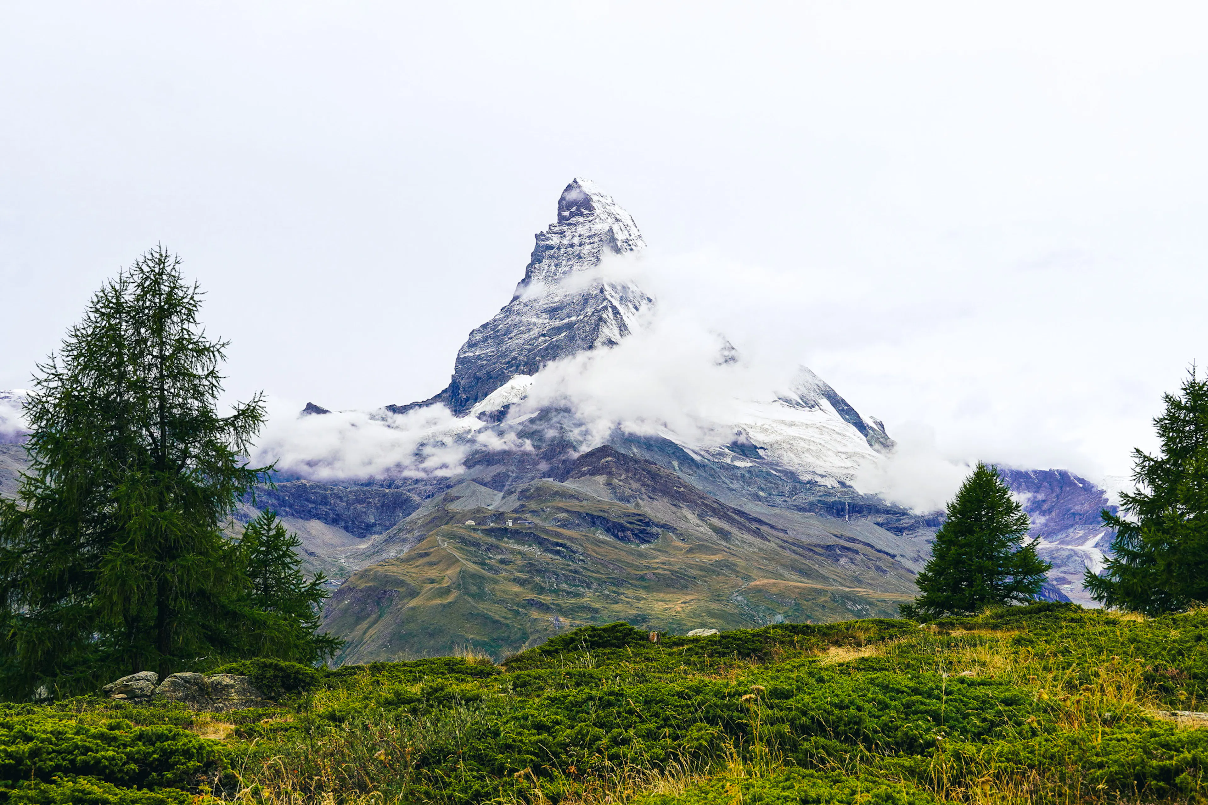
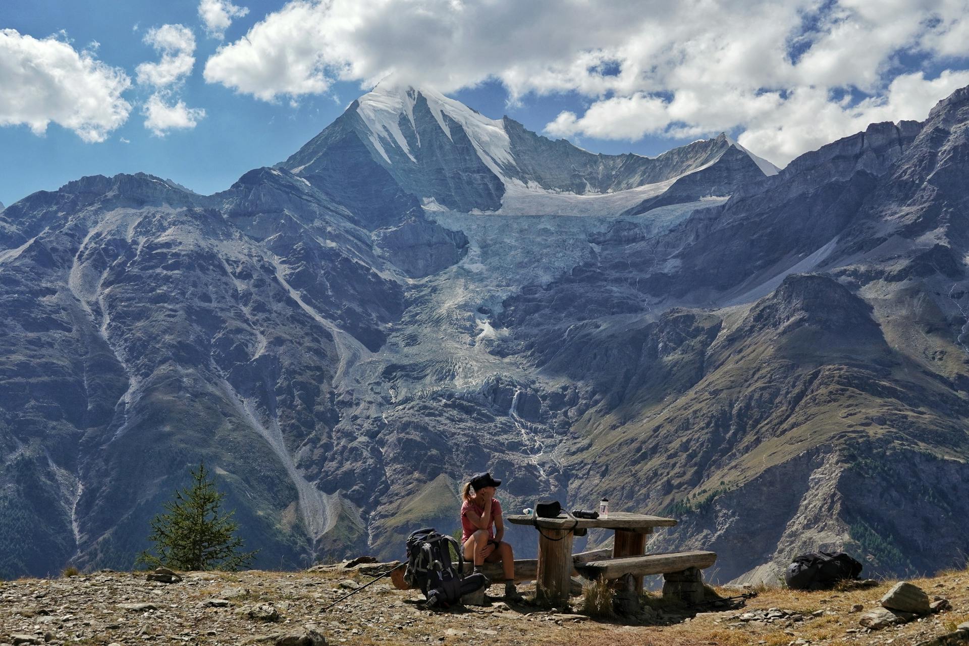
This route will take you to mountain passes just below 3000m, with views of many 4000m peaks as well as the iconic Mont Blanc (4.800) and Matterhorn (4.478m). You will also cross many lakes, valleys, and cute alpine towns. Definitely one of the most beautiful hikes out there. It is a hard hike due to the length and the amount of mountain passes you need to climb. There's nothing technical about the hike, it's simply long and therefore tough.
A scenic hike through the Alps from Chamonix to Zermatt
- LocationFrance, Switzerland
- Very Hard
- Distance219km
- Stages11 days
- Elevation Gain 16400m
- Elevation Loss 15800m


The Elevation Profile
Total Distance
-km
Elevation Gain
m
Elevation Loss
m
Max Elevation
m
Min Elevation
m
- Stage
- Point of interest
The route map
Create your perfect itinerary with our Hike Planner
Plan every stage of your hike with official routes, variants, and real-world trail data, all in one place.
- Curated hike data with official routes, variants, and more
- Design your hike stage by stage
- Find huts with real-time availability
- Download GPX files for your favorite navigation app
- Generate a printable PDF for your hike
"As hard as it gets this hike will reward you with stunning landscapes along the way"


Frequently asked questions
How to get there
The closest airport is Geneva Airport in Switzerland. From the airport you can take a shuttle bus straight to Chamonix. For example Easybus offers one way tickets starting from €17 and the travel time is 1 hour and 15min. When you finish the hike you can take a train back to Geneva from Zermatt.
Water & food
Natural water sources were good. We were carrying about 1 litre each in the beginning of the day and kept refilling during the day. For the climbs it’s important to refill because usually there’s no streams on the high mountain passes. Finding food took us by surprise: there were few towns where we were planning to eat but once we got there, there was nothing open. For example Trient and Fionnay were the biggest disappointments. The best supermarket we found was in Zinal, but there are minimarkets in Champex-Lac, Orsières, Les Haudères and St. Niklaus.
Accommodation
You can do the whole route without carrying a tent. There are numerous mountain huts along the route and you’ll go through many Alpine towns where you could stay in a hotel. Also, a few campsites can be found, in case you want to sleep in a tent but not necessarily wild camp.
Wild camping
On the French side it seemed to be illegal to pitch a tent in any circumstances. In Switzerland, it seemed to be more acceptable as long as you followed a few rules. You should always pitch your tent right before sunset and take it down right after sunrise. You should be above the tree line, so generally speaking above 2000 meters of altitude. However, in National Parks and game reserves it's illegal to pitch a tent even for a short overnight stay. For example around Lac Louvie it's strictly prohibited to pitch a tent.
When to go
The best time regarding weather would be from July to mid-September. Most refugios might be open from mid-June but be prepared that there would still be snow on the high passes until early July. We completed the hike in August.
Money
Card payments were widely accepted but we also carried cash for emergencies.
Expert hiking itineraries & personalized trip planning services
We offer crafted hiking itineraries in PDF format with all the information for your trip, GPS files for each individual stage, and the complete route, plus marked points of interest to help you navigate.
