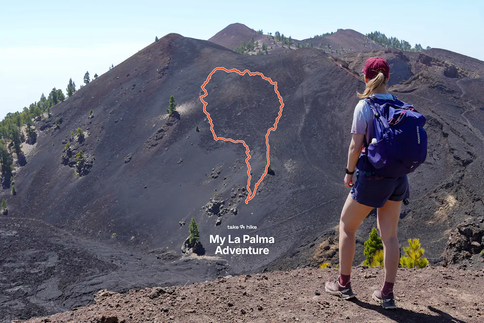
The Ruta de los Vulcanes is widely considered the best day hike in La Palma, and honestly, after doing it as part of our traverse of the island, we'd say that reputation is fully deserved. La Palma is one of the western Canary Islands, and this trail alone is a good reason to make the trip. It runs along the Cumbre Vieja volcanic ridge, connecting the southern town of Los Canarios (Fuencaliente) to Refugio Pilar, and it was the highlight of our whole route around the island.
What makes it so good isn't just the volcanic landscapes, it's the contrast. Dark lava fields and old craters sit right next to Canarian pine forest, and the light filtering through the trees while you walk over hardened lava is something we genuinely didn't expect. If you're planning a trip to La Palma and can only do one trail, this is the one.
The Route: Fuencaliente to Refugio Pilar
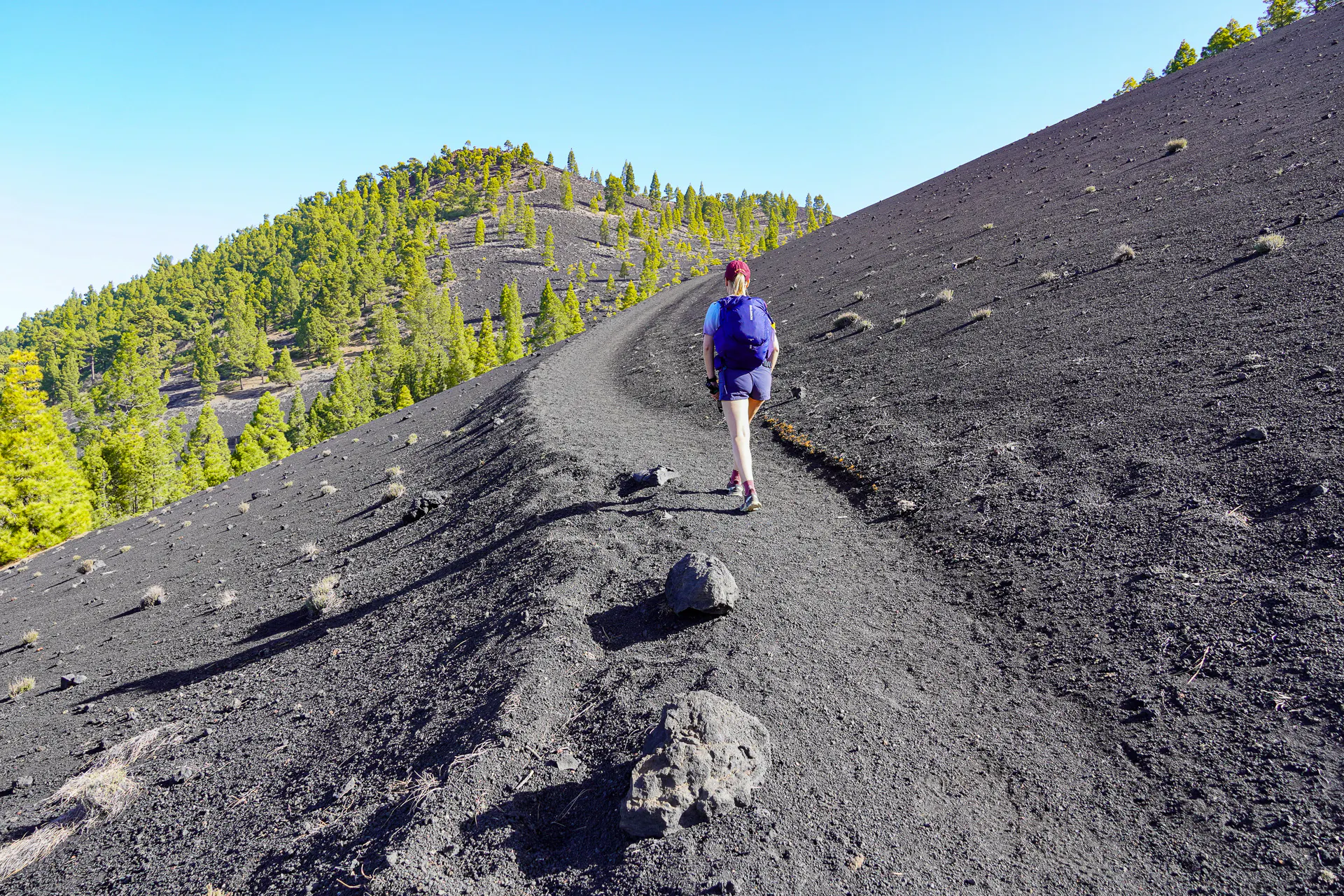
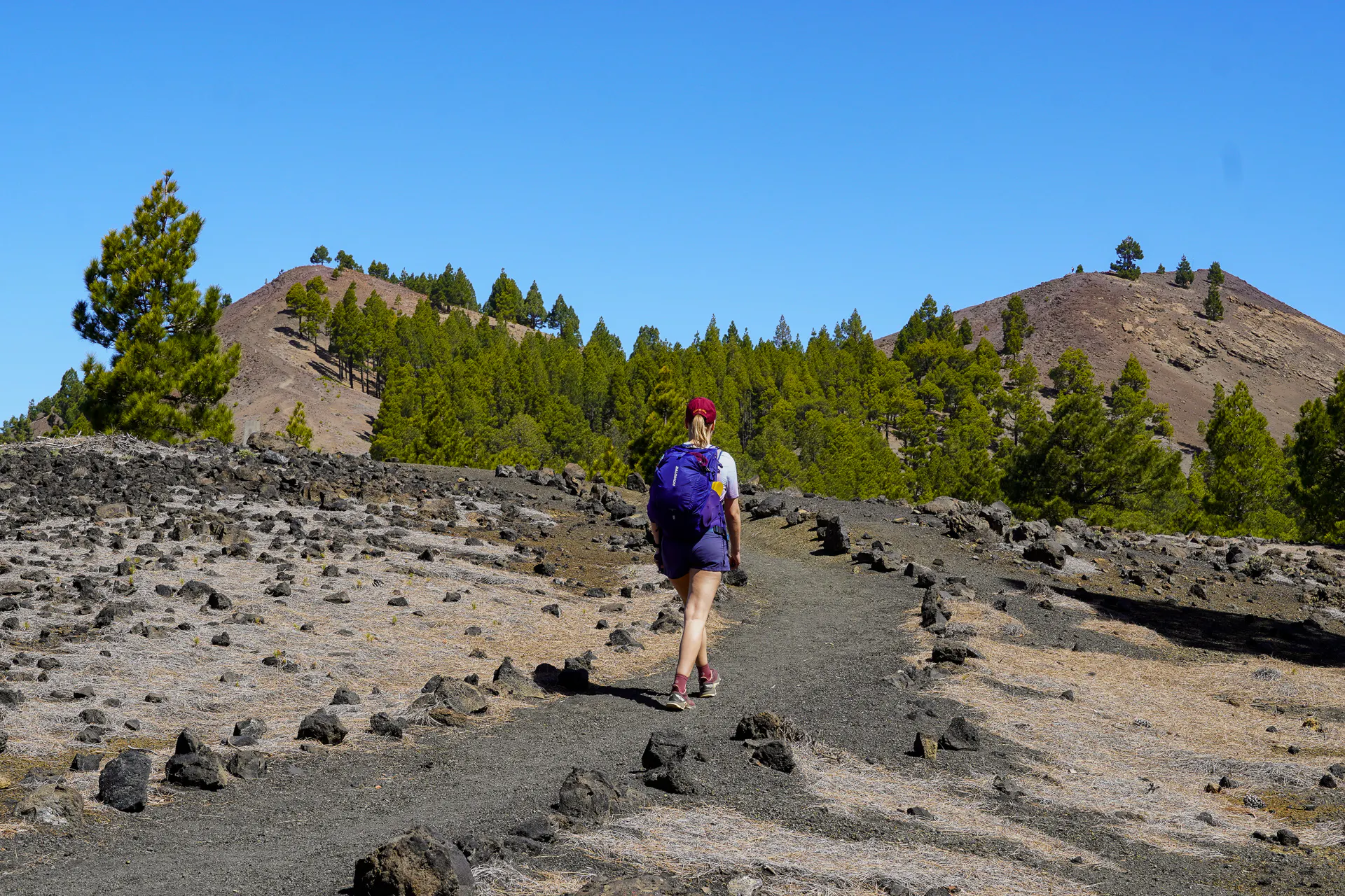
The trail follows the GR131 long-distance route from Los Canarios (the main town in Fuencaliente municipality) northwards to Refugio Pilar. Most of the steep climb happens in the first few kilometres, after that, the trail settles into a steady, gradual ascent along the ridge.
If you're starting from Los Canarios, it's worth knowing that the complete GR131 route actually begins further south, at the two volcanoes right at the very edge of the island: San Antonio and Teneguía. There's also a volcano interpretation museum nearby. We started our section from Los Canarios itself, but if you want to do the full route from the true southern tip, those volcanoes are where it begins.
One thing worth knowing: the majority of day hikers do this trail in the opposite direction, starting from Refugio Pilar and finishing in Fuencaliente, since that way is mostly downhill. It makes sense, especially if you're prioritising comfort or have legs that prefer a descent. We went uphill from Los Canarios, and it turned out to be a great decision: the trail was noticeably quieter in our direction, and the steepness at the beginning wasn't as bad as we feared. After the first 2–3 km, the gradient eases and you just gain elevation steadily for the rest of the day.
If you prefer a gentler experience, start from Refugio Pilar. If you want solitude and don't mind the initial climb, start from Los Canarios like we did.
Important note: bring enough water. There are no water sources on the trail between Los Canarios and Refugio Pilar. We carried 1.5L per person.
What you'll see: Volcanos, Craters, and Lava Fields
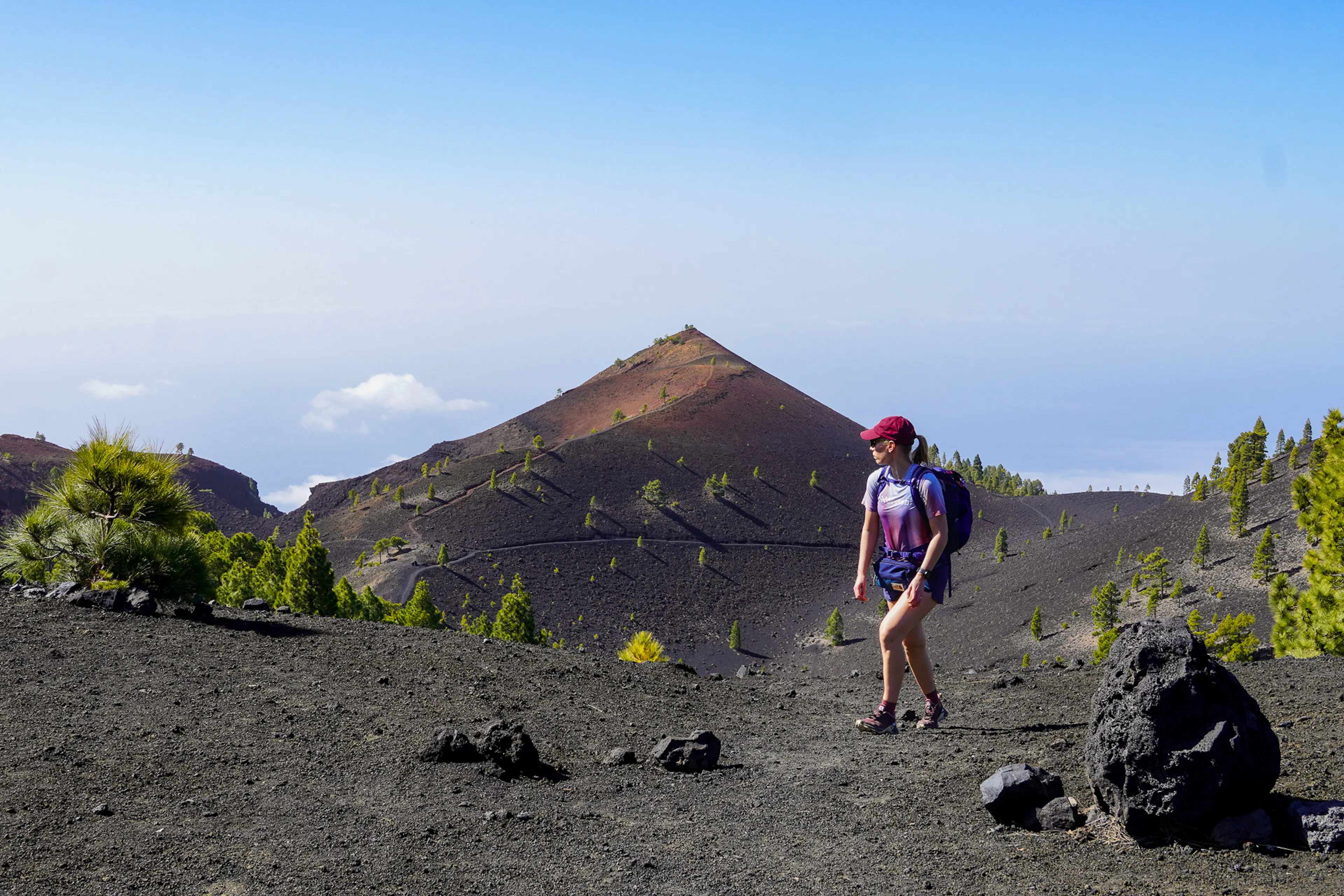
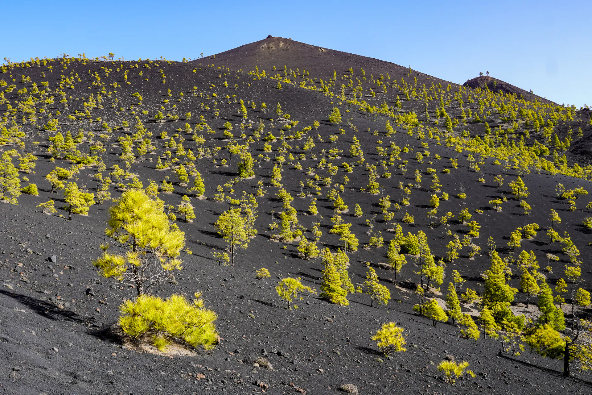
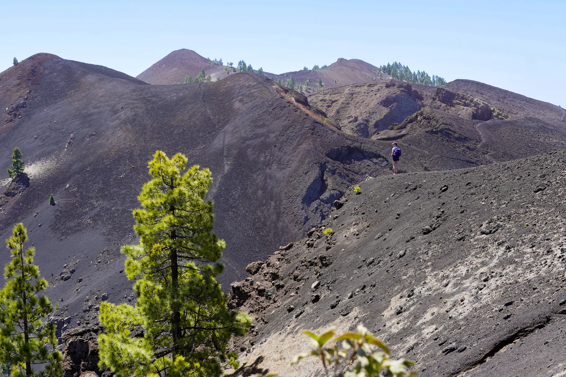
The Ruta de los Vulcanes lives up to its name. The trail passes by multiple craters and extensive lava fields, some of them with detour paths that let you get closer and look into the crater openings. You don't have to take every detour, but even sticking to the main trail, the volcanic scenery is all around you for most of the route.
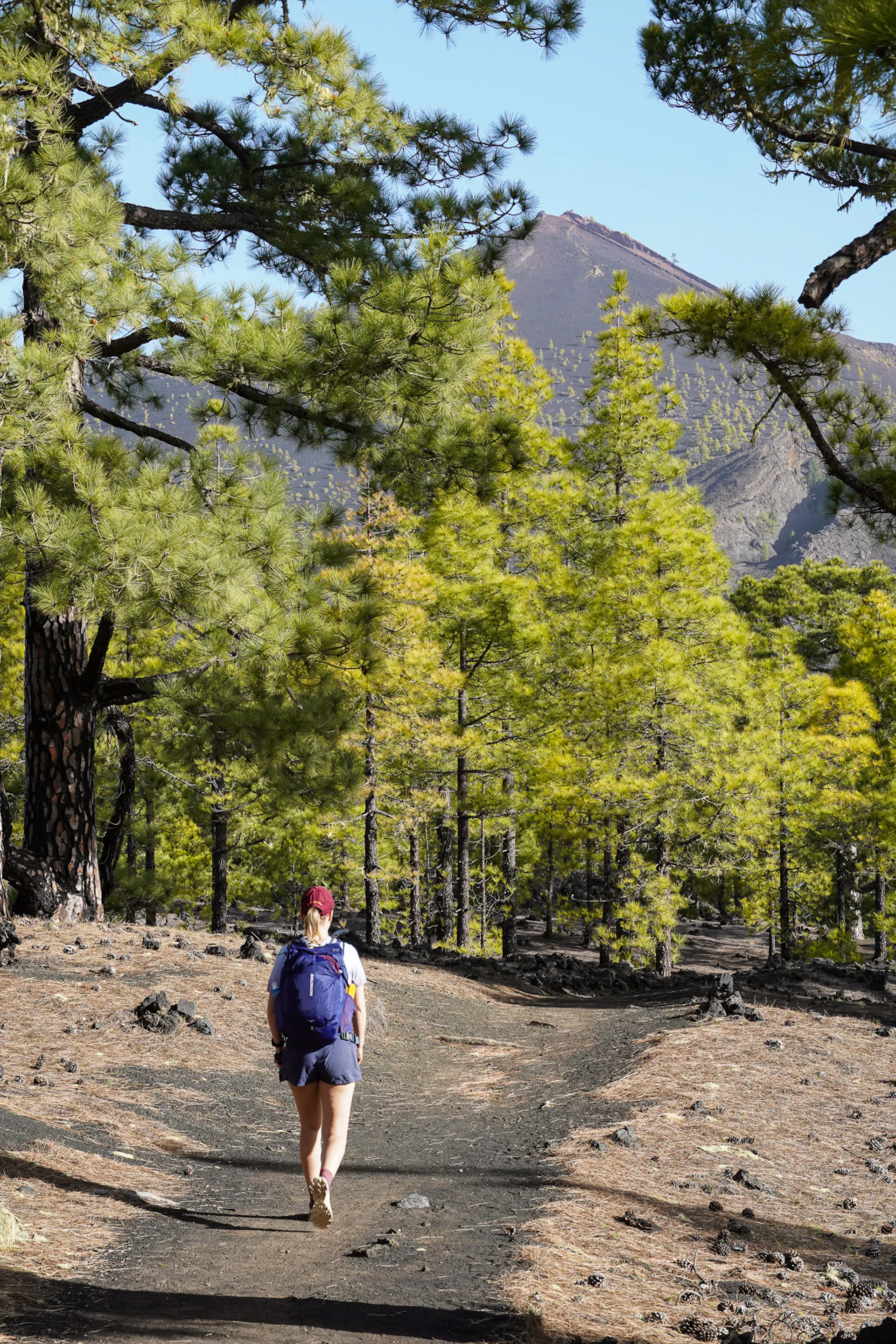
The surprise for us was how much green there was. We expected a barren, moon-like landscape for the whole route, but the Canarian pine forest keeps appearing throughout, and even in the more open volcanic sections, there's always some shade. The contrast between the dark, reddish-black lava and the pine trees is the defining visual of this trail, unlike anything we've hiked anywhere else.
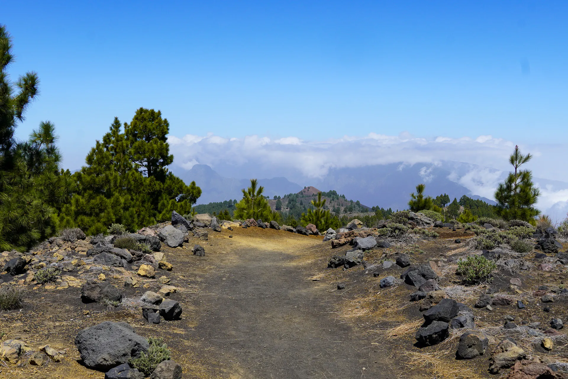
The highest point of the route is the Deseadas Peak, and reaching the top marks one of the best moments of the whole trail. From there, you get a direct view of the Tajogaite volcano, the one that erupted in September 2021. You can clearly see the crater and, below it, the path of destruction through the town and down to the coast. It's powerful and a bit sobering to see. The lava flow that covered entire neighbourhoods is still very visible, and standing there looking at it gives the volcanic landscape a much more real dimension than just walking through old craters.
You also get views from the ridge towards the Caldera de Taburiente, the enormous ancient collapsed volcano to the north, with its dramatic vertical walls. If you're continuing on the GR131, you'll eventually be hiking inside it.
Refugio Pilar
At the end of the trail, Refugio Pilar is a proper facility, not a mountain hut in the Alpine sense, but a well-equipped rest stop with bathrooms, a visitor centre, barbecue areas, picnic tables, and a campsite. There's even a small information area about the Tajogaite eruption and the volcanic history of the ridge.
It's a great place to rest after the climb. The campsite requires a permit booked in advance if you want to spend the night there. There's no building or dormitory to sleep in, just the camping area, so don't show up expecting a mountain refuge in the traditional sense. But if you've planned ahead and have your permit, it's a very pleasant place to camp, surrounded by pine trees.
We arrived and spent a good while there before figuring out our exit route, which brings us to the next section.


Getting there and back
The logistics for this trail are manageable if you plan ahead.
Getting to Los Canarios (Fuencaliente): Bus 210 connects Los Canarios with Los Llanos de Aridane, which is the main transport hub in the west of the island. If you are based in Santa Cruz de La Palma, you can take the bus 200. It's a local bus, so check the timetable in advance. If you're basing yourself in Los Llanos, this is the easiest way in.
Getting back from Refugio Pilar: This is the trickier end. There's no direct bus from the Refugio, so your main options are a private taxi arranged in advance, or hiking down to La Rosa via the PR-LP 14 trail and catching the bus from there. We went with the PR-LP 14 - see the dedicated section below for the full details on that route, because it genuinely deserves its own mention.


PR-LP 14: Refugio Pilar to La Rosa
The trail connects Refugio Pilar to La Rosa, covering around 7 km with a mostly descending profile. The terrain switches between pine forest and open volcanic areas, giving you a different kind of scenery than the Cumbre Vieja ridge you've just spent the day on. Where the Ruta de los Vulcanes is all about the ridge panorama and the old craters, the PR-LP 14 feels more enclosed and raw, especially as you get lower and closer to the Tajogaite zone.
Access into the eruption zone is still restricted, you can't leave the trail and wander freely into the affected area, and proper visits require an authorised guide, but hiking past it on the PR-LP 14 gives you enough perspective to understand how much the landscape changed.
At La Rosa there's a bus stop where you can catch a connection back to Los Llanos de Aridane or Santa Cruz de la Palma. The bus line is the 300 in both cases, just different directions. If you're doing the Ruta de los Vulcanes as a day hike, combining it with the PR-LP 14 makes for a full day with a clean, walkable exit.
The Ruta de los Vulcanes is one of those trails that's genuinely hard to oversell. The volcanic landscapes, the pine forest, the views to the Tajogaite, it all comes together in a way that makes for an exceptional day out. Whether you're in La Palma just for a few days or doing the full GR131, don't skip this one.